08.11.2023

Have you ever been drawn to the edge?

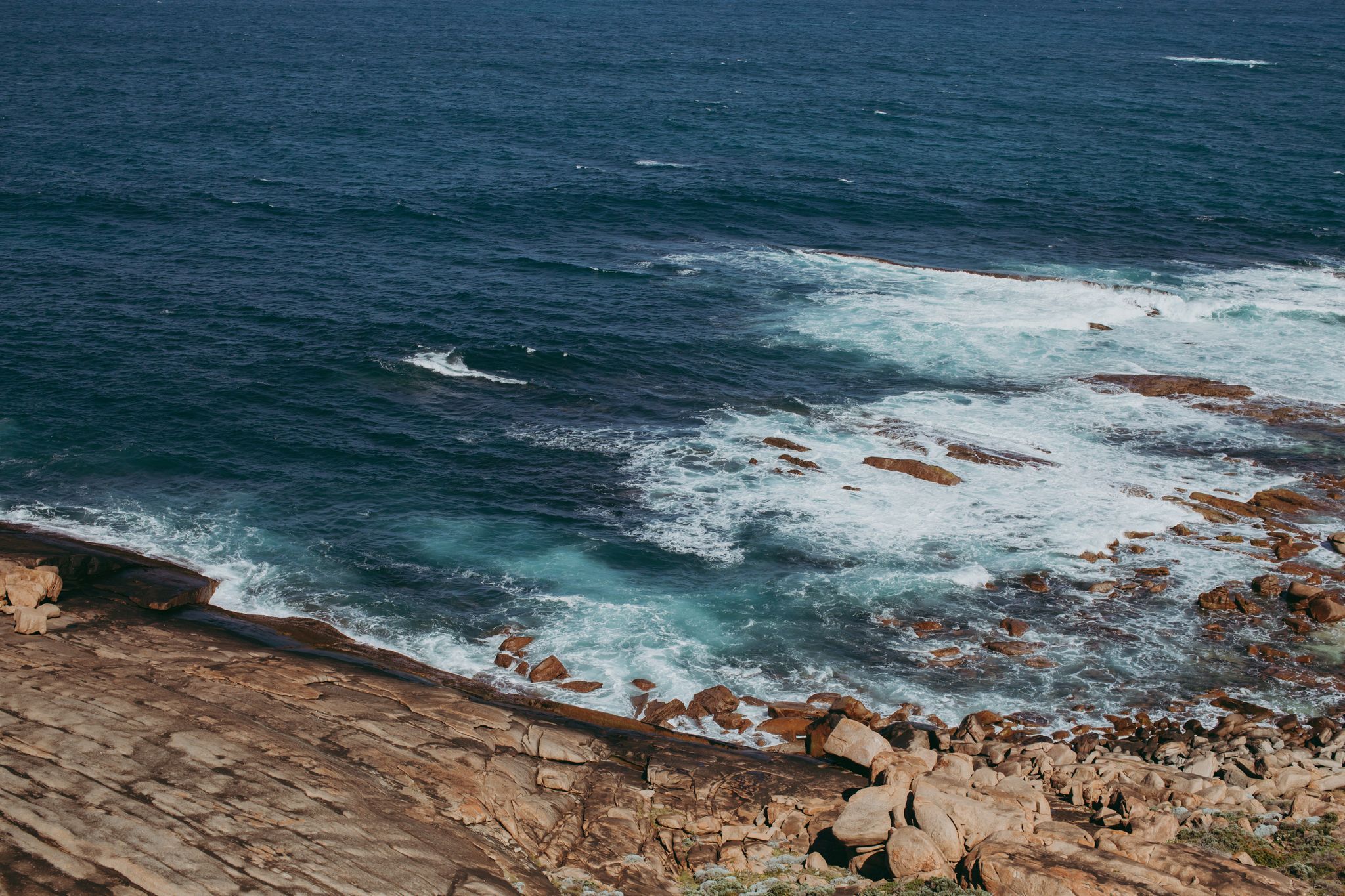
A rain squall announces its presence by rapping the windscreen on my car with the urgency of a touch typist. I stop at the aptly named Storm Bay Road on the outskirts of Augusta, a town that sits perched on the south-western extremity of the Australian continent. Between the rushed blur of my wiper blades, I can make out a couple of whales launch themselves out of the salty brine of Flinders Bay before crashing back in an explosion of blubber and whitewash.

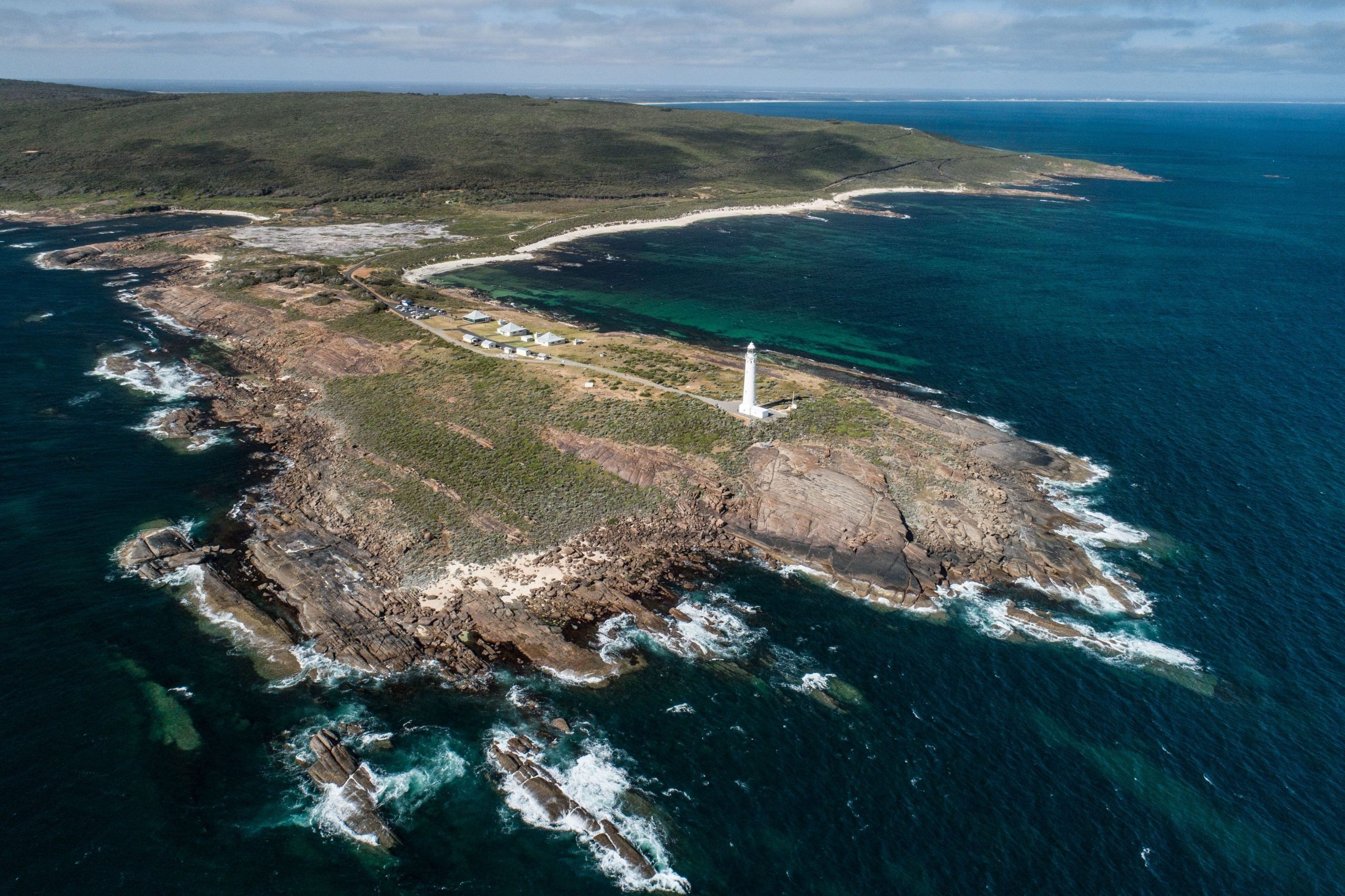
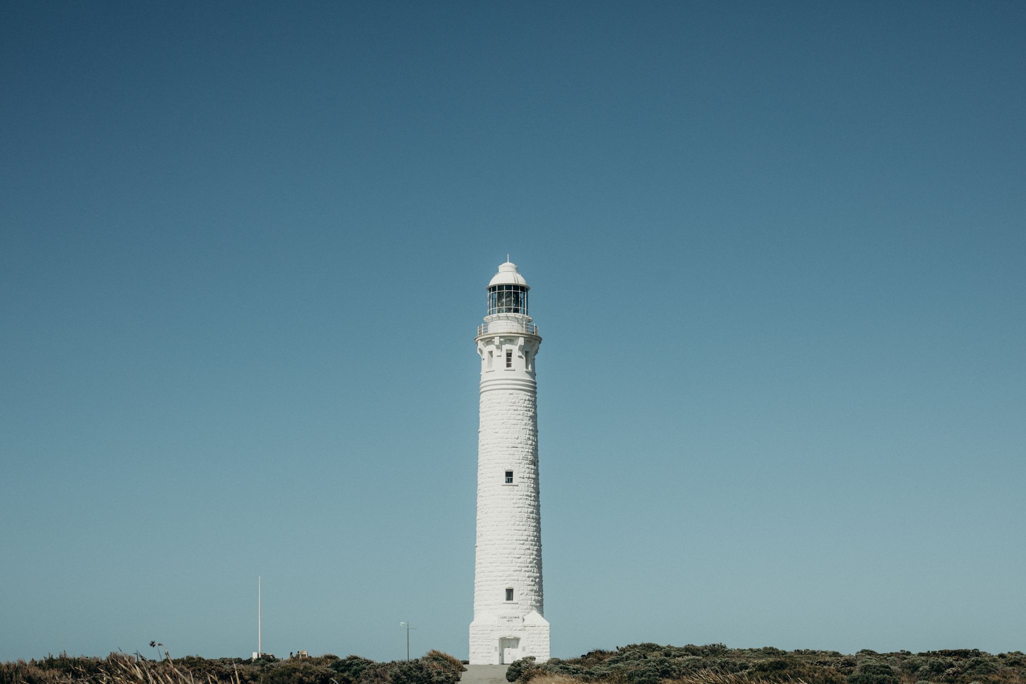
I’m on my way to Cape Leeuwin, one of the three great capes of the Southern Hemisphere. The others: Cape Horn in Chile and the Cape of Good Hope in South Africa both bookend the South American and African continents respectively. Whilst Cape Leeuwin is not the most southerly point of the Australasian continent, its exposure to the abundant swell of both the Indian and Southern Oceans is unparalleled.

Cape Leeuwin. Credit Ryan Murphy.
Photo credit Ryan Murphy.

Located at the climatic frontier of Australia, Cape Leeuwin possesses an almost magnetic draw that has the ability to make visitors feel like they are at the end of the known world. There is something about liminal spaces that speaks to many of us. Spaces that somehow manage to simultaneously separate and join. Cape Leeuwin is no different. The grand, yet imperceptible meeting point of two great oceans, a place where the land ends and the wilds begin.

Despite the vast distance between them, the three great capes are all connected by a conveyor belt of relentless westerly wind that circumnavigates the ‘Roaring Forties’ latitudes beneath them. Acting as gateways to the oceans of the Southern Hemisphere they share a unique importance in navigational and seafaring past and present. With no significant land mass separating the great capes from Antarctica, the unabated wind and swell beneath represent an inhospitable wilderness that is both terrifying and captivating in equal measures.

Cape Leeuwin Lighthouse Photo: Scott Slawinski
Photo credit Scott Slawinski.

Continuing on, only 4 kms of rain-lashed bitumen separates me from the Leeuwin lighthouse that stands sentinel at the tip of the cape. The lighthouse remains the tallest in mainland Australia, leaving no doubt to the significant navigational risk that the area posed and continues to pose to passing vessels.

On my way I pass a mass of gnarled melaleuca scrub at the side of the road, forced over at a 45-degree angle it appears to turn its back on the ocean by the ever-present might of the wind. The constant influence of this coastal breeze is felt across the Margaret River Region, influencing the flora and fauna of the area, moderating the temperature and delivering the rainfall in which life here has always relied.

Lighthouse keeper building at Cape Leeuwin Lighthouse. Credit Rachel Claire / Fieldnotes
Photo credit Rachel Claire.

For countless generations the local Wadandi people have known the cape region as ‘Doogalup’, yet it takes its modern name ‘Leeuwin’ (Lioness) from the Dutch galleon that first sighted it from sea 400 years ago in 1622. The Dutch took advantage of the strong westerly airflow at lower latitudes in the Indian Ocean to halve journey times between Holland and the Dutch East Indies. By 1611 the ‘Brouwer’ route became mandatory for Dutch ships on route to Batavia and surrounds.

Lacking an accurate way of gauging longitude, the vessels of the time relied on the expertise of the captain and crew to gauge when to turn north. As a result, the use of the Brouwer route led to the unintentional discovery and limited charting of the southwest corner of Western Australia by ships such as the Leeuwin as well as contributing to the numerous shipwrecks from this era along the coastline. Whilst there is no remaining documentation or log from the Leeuwin’s historic 1622 voyage, the coastline that was recorded during this maiden journey appeared on a Dutch map in 1627 by Hessel Gerritsz. In a nod to this significant maritime discovery, the English navigator Matthew Flinders formally named the cape ‘Leeuwin’ in 1801.

View from inside Cape Leeuwin Lighthouse. Credit Ryan Murphy.
Photo credit Ryan Murphy.

Taking advantage of a break in the weather, I make my way from the Lighthouse Interpretation Centre by foot and towards the oceanic roar. During my walk I reflect on the historical context of the cape. The 400 years that separates the sailors aboard the Leeuwin from my life, all but a blink in the unbroken continuity of time that the vastness of the sea has butted up against vastness of land here.

Before long the sparse coastal vegetation makes way to bare rock. I get buffeted by a blast of salt laden air. Steadying myself I look out to sea and try to superimpose a mental image of the Leeuwin rounding the cape. I wonder what those sailors made of the place I am now stood? How did the unexpected sighting of land, likely a consequence of a significant and potentially perilous navigational error make them feel? Did the great unknown land in front of them inspire a similar blend of fear, awe and respect that rises up within me as I gaze across the turbulent seascape stretched towards the horizon.

Despite existing in a state of constant environmental flux, Cape Leeuwin presents visitors with an opportunity to pause. To feel the ancient Gneiss bedrock underfoot as you lean into the untamed westerly breeze. A wind that has travelled around the globe to meet you and will not stop until it meets Cape Horn in 10,000 clicks. Despite the restlessness of elemental forces around, it presents a rare solace worth seeking out: A place where all the problems of the human world are behind you.

Cape Leeuwin Lighthouse. Credit Ryan Murphy
Photo credit Ryan Murphy.

Advice from a Local

Speak to a local expert Advice from a Local Our team of local experts

Our team of local experts are here to help plan and book your stay in the Margaret River Region.