France was embarking on a political and military transformation. It was eager to reassert proud national leadership in science and the arts. With a great ceremony, two sailing ships were farewelled at the French port of Le Havre. Theirs was to be the greatest scientific expedition ever launched. The ships were corvettes with guns, each just 40 metres long. They were given new names to reflect the expedition’s lofty aims.

Header image: @coastingoutback

Géographe and Naturaliste were to sail to the land called New Holland to explore along its coast, mapping and observing, engaging with the local people and studying them, drawing, collecting a vast trove of objects and specimens, including quadrupeds, birds, plants, and minerals. Interesting animals and plants were to be brought back alive.

Crammed with 238 men, the expedition was under the command of the experienced naval officer, Nicolas Baudin. In addition to their sailors, the two vessels were jam-packed with scholars, scientists, artists and even gardeners to care for the plants they would collect. The ships’ officers were quarrelsome. The scientists and artists were an unruly and impatient lot. They resented the rigours of shipboard life. In turn, captains did not abide landlubber passengers. When they were delayed in Mauritius to fix storm damage and collect supplies, more than forty officers, scientists and artists walked away. Baudin pushed on for New Holland, now well behind time, making do with the grizzly lot he had left.

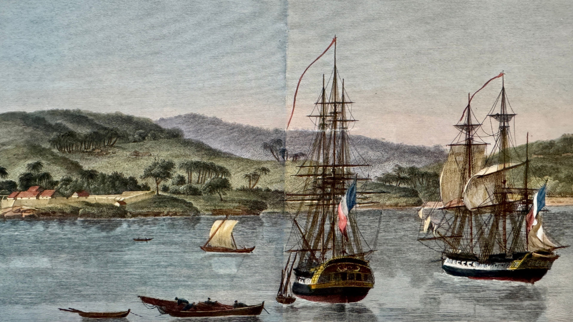
Géographe and Naturaliste at Kampung in Timor. An etching from Stuart Hick's collection. Drawn by an assistant ship's gunner, Charles-Alexandrew Lesueur, who became on of the Baudin expedition's official artists.

A left turn

The expedition arrived in the vicinity of Cape Leeuwin on 27 May 1801. They could find no safe anchorage and were confined to their ships. The southern winter was approaching. Baudin decided to postpone his planned itinerary and instead sail north to Timor, where he intended to rest and repair through the winter months before returning south, around Cape Leeuwin, to proceed eastwards and explore Australia’s south coast after the weather improved.

It was the decision to turn left, not right, at Cape Leeuwin, which took Baudin’s ships along a part of the Australian coast that no Europeans had previously recorded. This was land where the Wadandi People had lived for 60,000 years or more. These locals knew every rock and stream, every centimetre of their country, their Boodja—from the place in the south they called Tallinup (that we now call Augusta), through Wooditjbilyup (Margaret River), to Undalup (Busselton) and up to Goomburrup (Bunbury). They had names for everything, but the Europeans were insensitive to that.

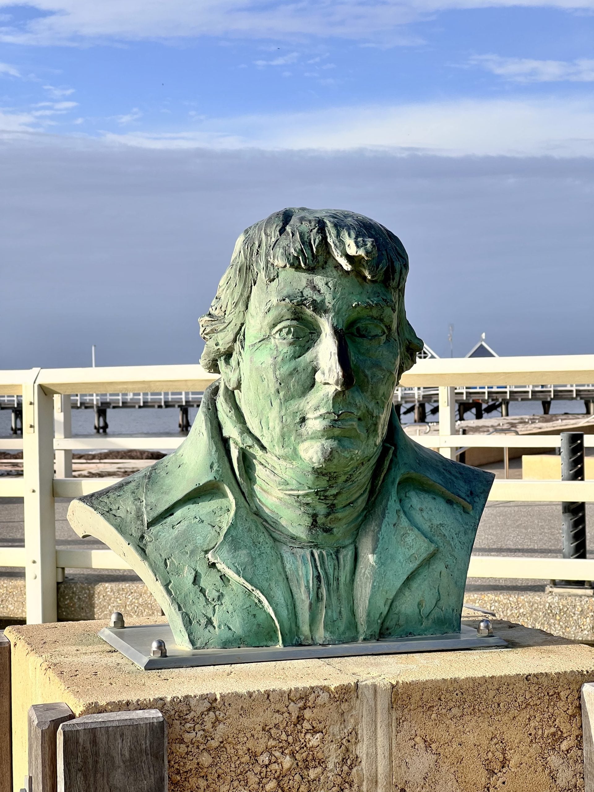
French commander Nicolas Baudin’s bust at Busselton Jetty. Image: supplied

By tradition, when European voyagers described and mapped a stretch of coastline in the ‘New World’, they exercised the explorers’ privilege of naming the features they ‘discovered’ along the way. Baudin’s ships sailed north along the coast of what is now called the Margaret River Region. They mapped and sketched the landforms they imperfectly made out through telescopes from their ships while maintaining a prudent distance from unseen hazards along the shore.

The French sprinkled names on the features they could identify at such distance—the little headlands. At length, the explorers were surprised to come to a prominent headland which they rounded, entering a giant bay. The headland they named after one of their ships, Cape Naturaliste. The bay was named after their other ship, Géographe.

Near the place we today call Eagle Bay, Baudin permitted his excited scientists at last to row to shore in the small ship’s boats, to set foot on Australian soil.

A blundersome adventure

Over the next week or two, they made a bit of a mess of it.  One objective of the mission was to study the ‘character and customs’ of the local inhabitants and to commence business negotiations, ‘to give them an idea of our arts and crafts and industries and inspire in them the need for our products’. The few Wadandi People they found were not interested in cultural or commercial interchange. They made it clear where they wanted the visitors to go, which was far from Wadandi Boodja.

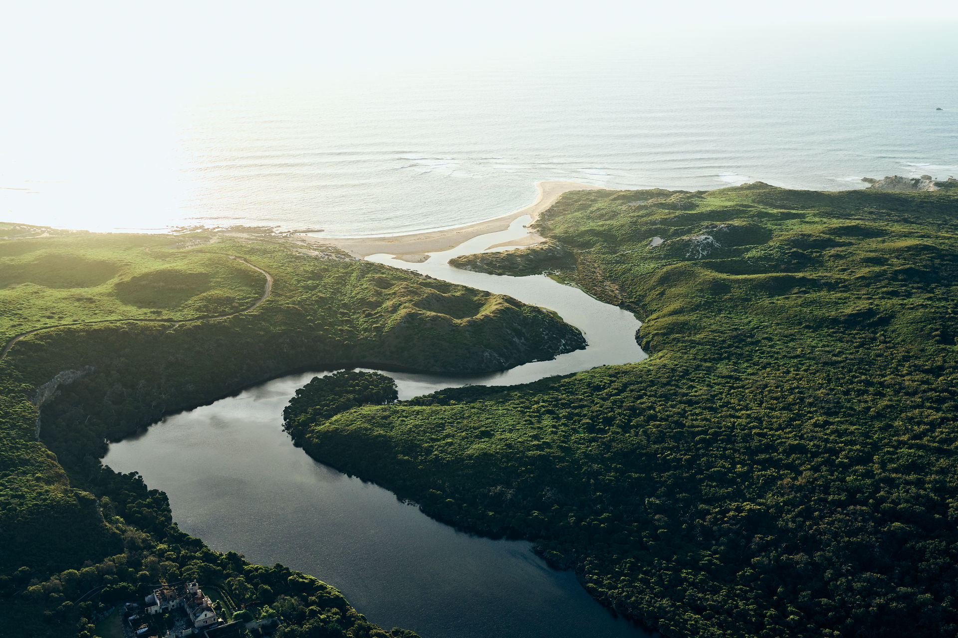
Before they were forced to flee the region in a gale, the French found a river.  At its mouth, the longboat of the Géographe became embedded in sand and had to be abandoned; a sailor, Thomas Timothée Vasse, was drowned. His name was given to the river. In exasperation at the perceived incompetence of his officers and crew, Baudin named the river mouth Anse des Maladroits—Blunderers Cove.

Cape Mentelle. Image: Ryan Murphy

So why was Baudin all but forgotten?

The scientific expedition collected 200,000 specimens of plants and animals, 2542 species of which were new to European science. It published the first detailed map of the entire Australian continent. But Baudin died before he could return to France. By the time the ships came back, France and Napoleon had turned their attention to more military ambitions. The vast Australian treasure that the Baudin expedition brought back was never fully studied or appreciated, although a kangaroo and two back swans ended up in Joséphine’s garden at Malmaison, along with hundreds of unique plants.  

The privilege to write the official record of the expedition was granted to the expedition’s last remaining zoologist, François Péron. Péron was ‘thoughtless, scatterbrained, quarrelsome, indiscreet, uncompromising’. (They are Péron’s own words, not mine.) ‘I have the capacity to make enemies for myself and to alienate my best friends,’ he confessed. Péron and his late commander, Baudin, had been shipboard enemies. So, Péron wrote the expedition’s volume without once mentioning Baudin’s name. Following this lead, Baudin was largely washed from history.    

In the official records, Péron and the cartographer Louis de Freycinet altered many of the names Baudin had proposed during the expedition. In the process, they attached their own names to some of the landforms while avoiding names that might recognise Baudin or his views of his officers and crew. The enmity was evident when they bestowed the name of Point Picquet on the eastern edge of Eagle Bay, where the men first set foot on Australian soil. The name they chose honoured a junior officer who they considered Baudin bullied during the voyage.
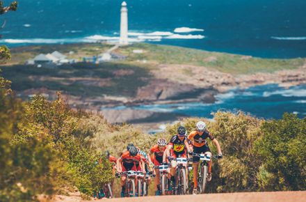
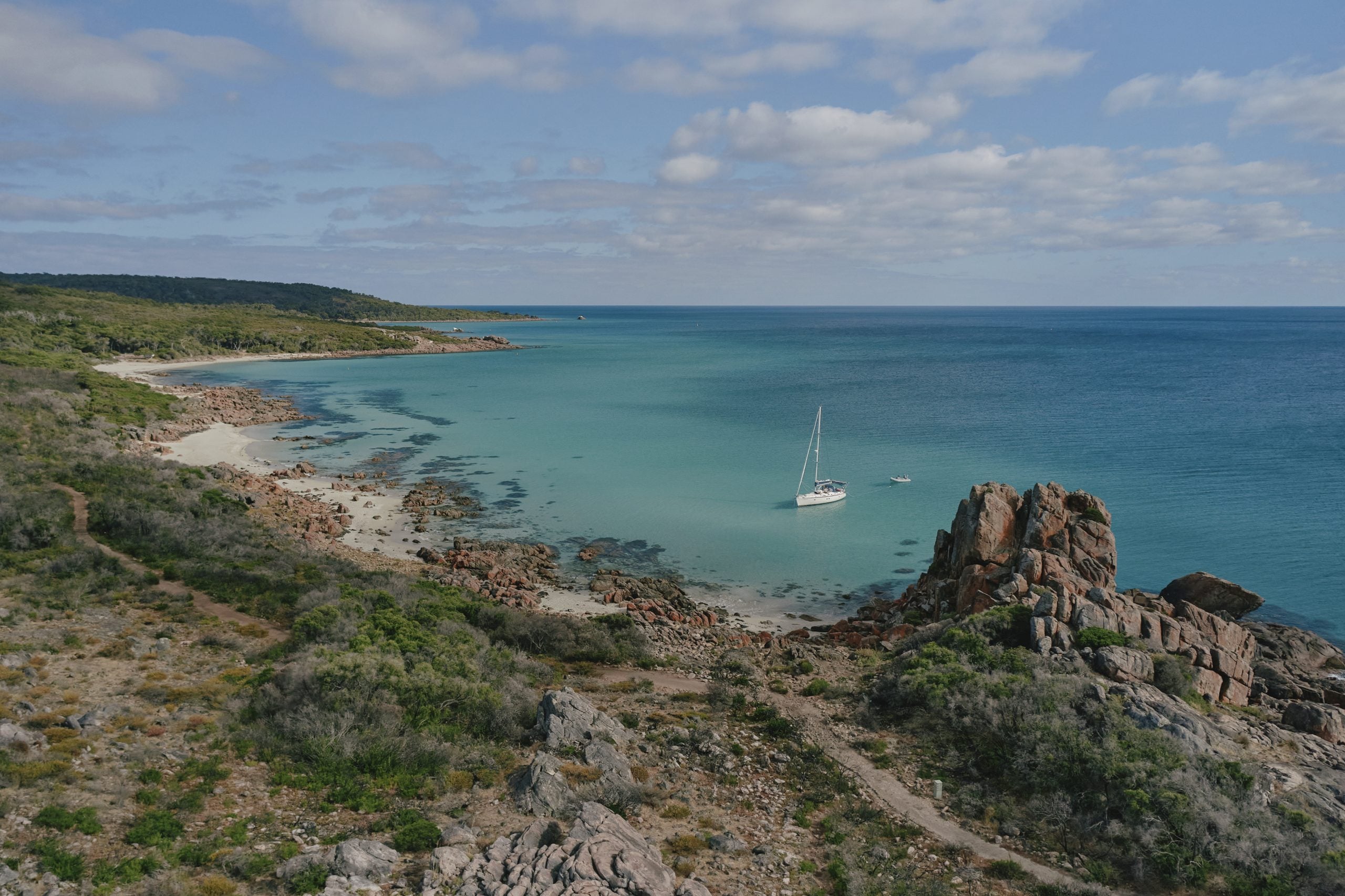
Castle Rock in Geographe Bay. Photo: Tim Campbell

Within decades, the British came to settle the west coast of Australia. Preserving maritime honour, they retained nearly every French name that had been officially conferred by Péron and Freycinet. Baudin didn’t get a mention. One distinguished scholar of the French expedition, Leslie Marchant, has argued that Geographe Bay should rightly have been named Baudin Bay. Instead, it was British colonists who attached Baudin’s name to a south-western cockatoo species, which we don’t know Baudin ever saw.

But Baudin is making a comeback. His bronze head is today mounted near the land-side tail of the Busselton Jetty, glancing wistfully towards Blunderers Cove.  It’s one of Baudin’s more colourful place names that’s disappeared; maybe more’s the pity because there’s a story in every name.

Geographe Bay is located at the northern end of the Margaret River Region and incorporates the towns of Busselton, Vasse and Dunsborough. For further insight into the European History of the region, visit Cape Naturaliste Lighthouse, Railway House, Busselton Museum or Wonnerup House.

Advice from a Local

Speak to a local expert Advice from a Local Our team of local experts

Our team of local experts are here to help plan and book your stay in the Margaret River Region.